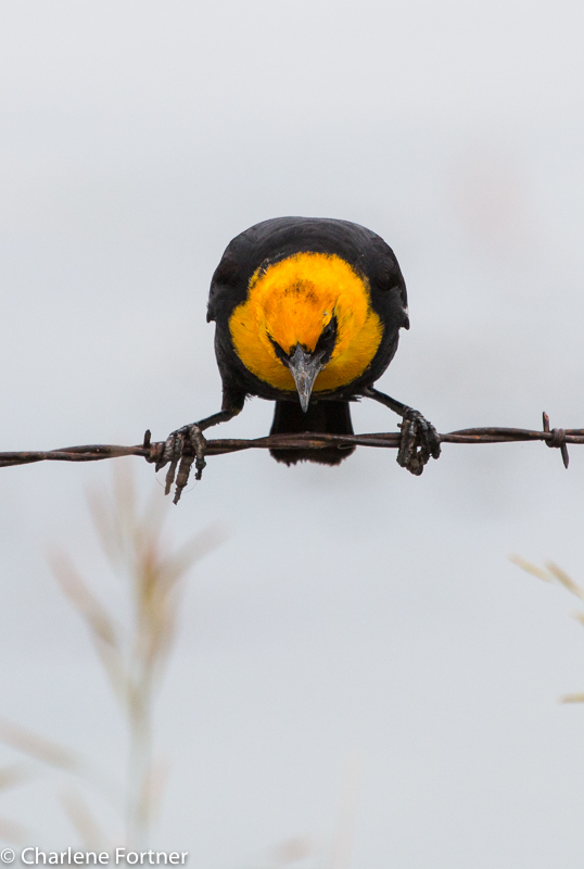
Yellow-headed Blackbird
Elk Creek Rd., SD
Yellow-headed Blackbird
Elk Creek Rd., SD
Sorry for the time between posts, but the beginning of each school year is a little hectic and time consuming.
Now settled in, I hope to get back to processing photos from my trip.
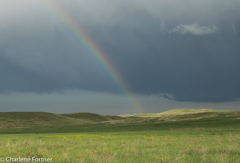
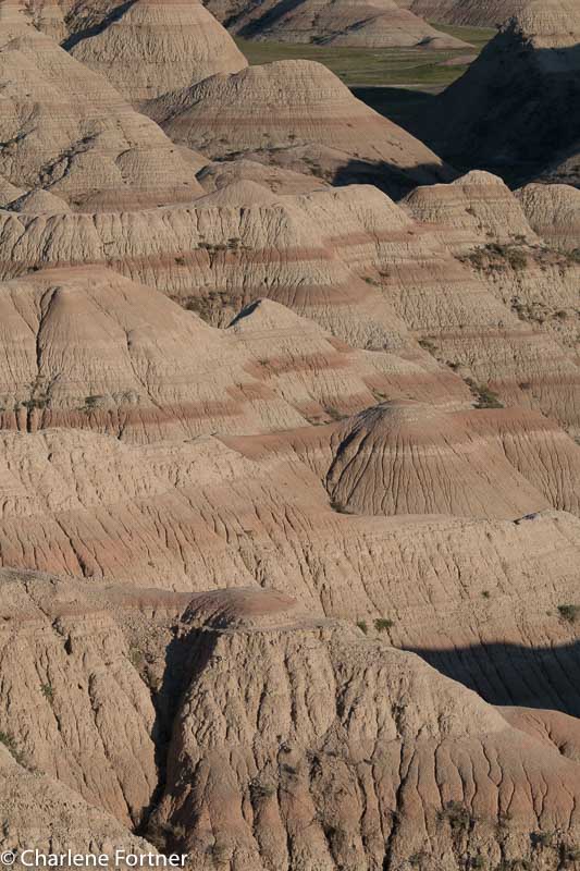
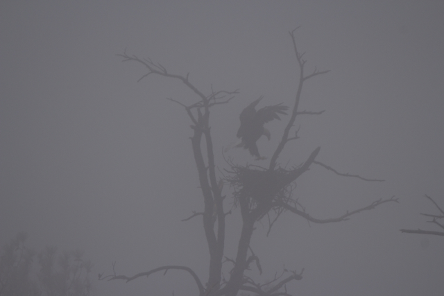
Custer State Park
Wildlife Drive
June 20, 2015
While passing through Illinois, I stopped at Mermet Lake State Fish & Wildlife Area. The cypress swamp is encircled by a two-way dirt road which I drove counter-clockwise. As a birding location I was disappointed to find very few species here, but the time of day and time of year were not favorable. The road was in good enough condition and wide enough to stop for wildlife and still allow other traffic to pass (a characteristic a lot of National Wildlife Refuges lack!). Located throughout the drive were small picnic/rest areas with bathroom facilities and several pull-outs to stop and look for wildlife. The site also contains two marked interpretive trails, but I did not try either due to the heat.
My favorite photo was of a Great Blue Heron, below. Another great find was the Mississippi Kite, which I did not identify until I downloaded the photos later.
Click Here for more information about this location.
Click Here for more information about this hotspot from eBird.
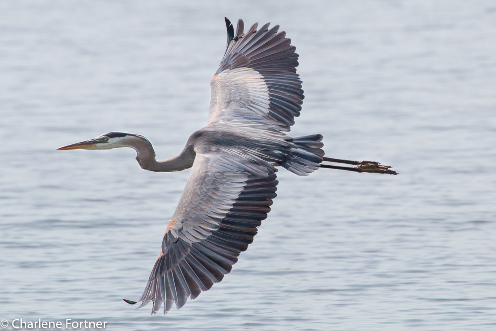
Great Blue Heron Mermet Lake SFWA June 2015
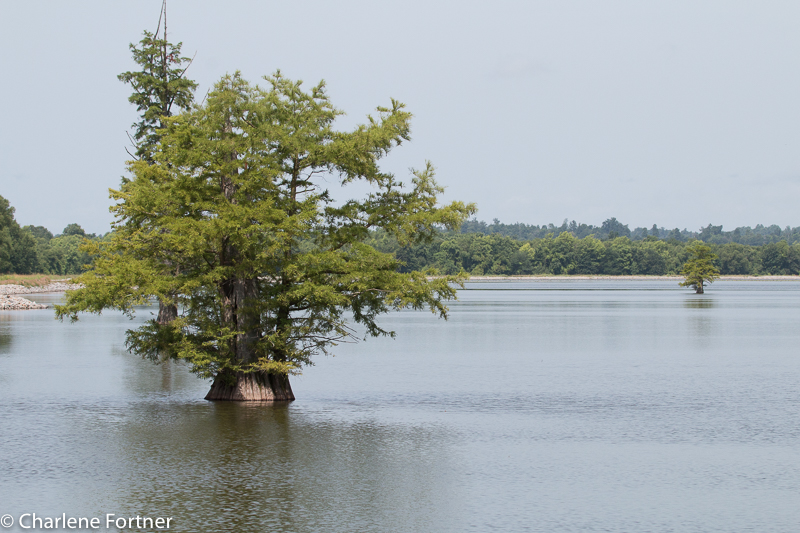
Mermet Lake SFWA
The past few days I have been without cell phone reception in the Beartooth-Absaroka Wilderness area surrounding the Beartooth Scenic Highway on the MT/WY border.
On Wednesday I left the Badlands and traveled west to Red Gulch Dinosaur Tracksite in Wyoming. An out-of-the-way, another dirt road location that didn’t even have an address! The area reminded me a little of the Badlands. I arrived later than I anticipated due to poor weather cleaning up camp in the Badlands. I mean, who needs to put down a tent in torrential rain and 30mph winds!
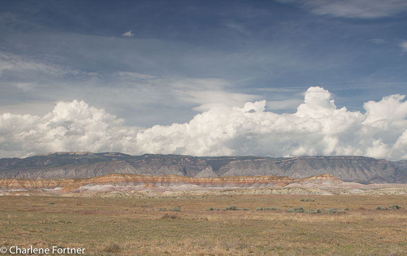
Red Gulch Area, WY
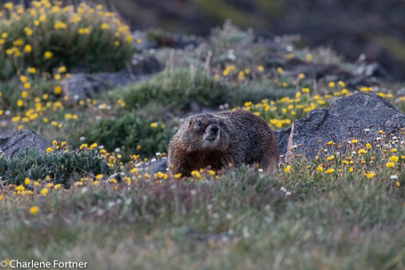
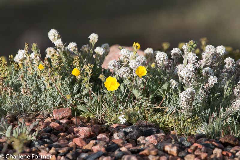
The Beartooth Scenic highway was very beautiful. A high alpine environment with many lakes and wildflowers. And marmots, of course! The highlight was spotting mountain goats on my last night there. Both days were cool during the morning hours (on Thursday, it was degrees F in the morning!) and warmed significantly during the day. Despite this, snow still covered about 10-20% of the highest passes along the highway.
Beartooth Scenic Highway,
Marmot
Beartooth Scenic Highway,
Wildflowers
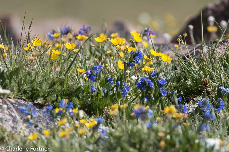
Beartooth Scenic Highway,
Wildflowers
On Friday, I got up early to travel northwest of Red Lodge, MT to the northern side of the Beartooth-Absaroka Wilderness to the Mystic Lake Trail Head off of West Rosebud Rd. Yet another long dirt road, it’s becoming a pattern that is hopefully not harming my car. 🙁
This trail was a grueling 3.2 mile hike uphill to the lake and a mind-boggling, full on concentration (so I don’t become Mrs. Humpty Dumpty) on the way down. I’ll do a more specific post on this hike later.
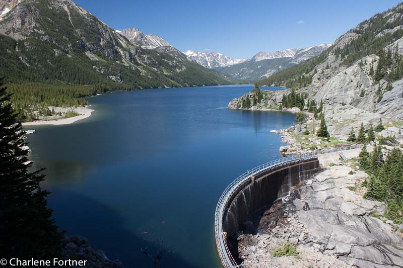
Mystic Lake
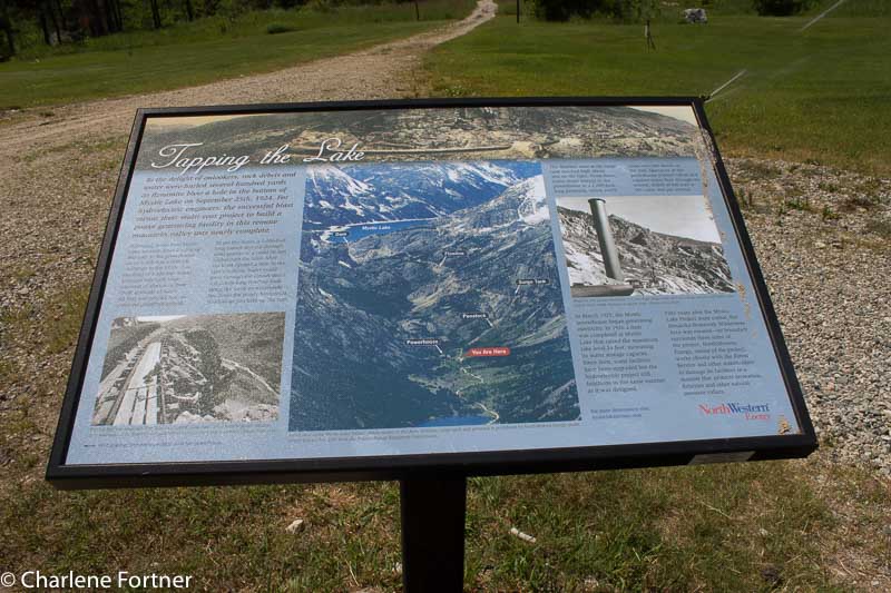
Information on the Hydroelectric Dam on Mystic Lake
I’m ALIVE. I got up really early (0430) to take sunrise pictures and instead I was disappointed to find a storm. I hit the road anyways thinking that the photo opportunities would still be great. I headed to the spot I selected the night before for sunrise and was met with a lightning storm. I braved it a little anyways, figured it would result in a nice shot. I wasn’t out there alone, so my consolation was that if I died, I wouldn’t die alone. 🙂
Spent another wonderful day at Badlands NP. Found a new Burrowing Owl family!
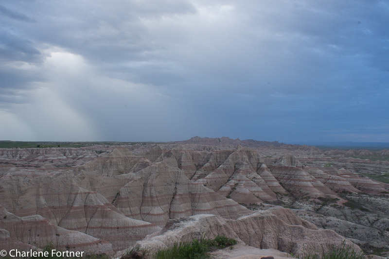
Badlands NP Sunrise Storm
Badlands NP Evening Glow
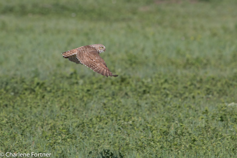
Burrowing Owl
Badlands NP
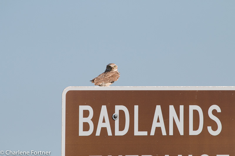
Burrowing Owl
Badlands NP
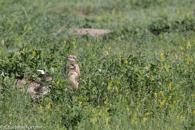
Burrowing Owl
Badlands NP
Western Unit, these are older than the other group on the scenic drive in the main unit.
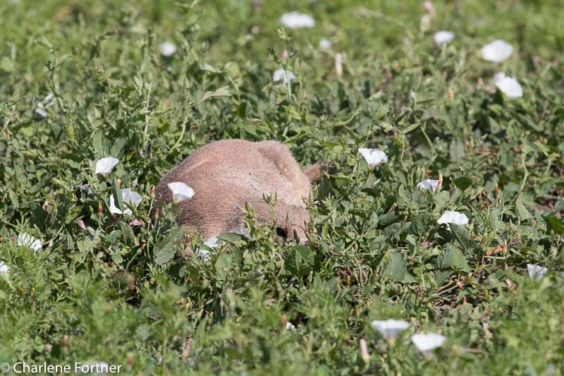
Prairie Dog
Badlands NP
Maybe if I lay down here in the grass, she can’t see me?
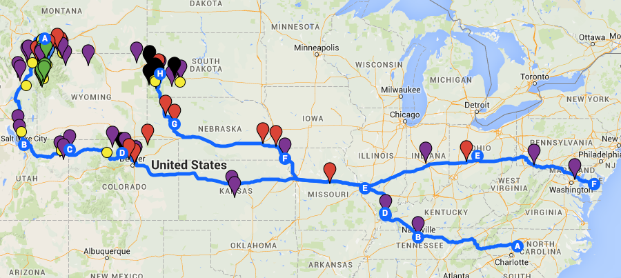
In just 10 days I’ll be heading west to the Black Hills and Yellowstone areas of South Dakota and Montana, USA. Months of cursory and serious planning will culminate in 29 days on the road and an additional 5-7 days in Delaware.
A good friend curiously asked me a few days ago, “How did you plan this?” Well…
Step 1: Where am I going? Why am I going there?
This step is by far the easiest, but also the most time consuming. Years ago, I compiled a list of 30-35 trips I wanted to complete while I am still able, ranging in duration and activity level to specific times of the year. Looking at my budget and season, I determined the highlights of this particular trip would be the Badlands and Yellowstone.
Since I am traveling by myself (the dog counts, doesn’t he?) the hard questions that come after deciding on a destination are easier than if you have to consider the interests and travel styles of many travel partners. I used Google Maps to set up a custom map. I researched as many online and print sources (guidebooks, travel websites like Tripadvisor, local and state tourism websites, chamber of commerce, eBird for birding hotspots, etc.) to add pins for EVERYTHING I want to see. Trust me, it can be a bit overwhelming when you start adding hundreds of dots to the map!! This process is the most fun, and depending on your transportation and your time commitment, the farther outside your immediate location you can explore. During this part I did NOT do in-depth research into any of the places I was adding, just preliminary to determine whether it was something I was interested in.
I had originally decided to travel north after Yellowstone to Glacier National Park and along the Canadian border to several National Wildlife Refuge hotspots in Montana and North Dakota. I finally settled on a southerly path through Salt Lake City and Denver. It didn’t save me any money or time to make the switch, but there were a lot more things to see with shorter travel time between them. That itinerary change essentially wasted probably 20-30 hours of dedicated research; but I kept my notes for future trips.
My reasons for traveling to these areas play a role in the locations I add. My interests are photography, birding, hiking and scenery. While I enjoy museums, this particular trip needs to be as dog-friendly as possible. I’ll be boarding Ari for two sections of my trip, so I will get to visit a few.
Step 2: Setting an Itinerary
Not as fun as the initial research, setting an itinerary can be quite challenging. During this part it is essential not to overestimate your abilities (something I regularly do, will I ever learn my lesson?). Important things to consider:
Since I am traveling solo, there are considerations I take when making an itinerary. I try not to stay at small (<10 or 15 sites) campgrounds when possible and preferably at ones where an attendant is on duty. If I’m in bear country I tend to consider trails that are more heavily used so that I’ll not be on the trail alone. I personally prefer the paths less traveled so I walk a fine line with this guideline.
As a photographer with a dog, I’ve limited my activity to mostly daylight hours. There are a few exceptions: the lighting ceremony at Mount Rushmore and astrophotography at Badlands National Park. I researched the civil twilight and sunrise/sunset times for the hubs of my trip (Rapid City SD, Livingston MT, Salt Lake City UT and Denver CO) to determine my general daylight allotment.
Some good advice given to me by a friend years ago was to stay in one place and explore rather than moving camp each day. While I’m trying to hold true to this I will be moving a little bit within each of the 4 sections of my trip. For 34 nights I have 19 lodgings. Granted the last section traveling between Yellowstone and home via Salt Lake and Denver is 10 nights with 9 lodging locations. Setting camp and not having to worry about it will be a great time saver when trying to compose early morning and late evening shots and when exhausted after a long day’s hike.
Once I set a hub (campground) I try to cluster sights to minimize the amount of travel time between them. I didn’t particularly want to spend half the day in my car and would much rather spend more time on location. This is the part when the dots on the map begin to get a little sparse. More in-depth research of cluster areas of dots help me determine which areas to check out. Say I have a cluster of 5 dots and only one of the dots is really promising, I’d give up that cluster in favor of another cluster where there were more places that interested me. Outlying spots of great interest do stay on the map for a couple of reasons: perhaps the weather is bad and its just far enough to provide a reprieve from bad weather and still remain active or perhaps a particular place wasn’t as interesting and I didn’t spend a lot of time there and have time to explore something else. I also keep several back-ups in case of inclement weather. With a dog, I’m limited in what rainy day activities I can participate in, but in the sections where I am boarding him I have more freedom. If it is particularly stormy, it may be cool enough to leave him in the car to see a small museum.
The last part of the itinerary once I’ve identified my hubs and clusters is deciding how to arrange the sights in a way that appeals to my interest. Photography and birding are both better at early morning and evening time frames whereas landscapes, museums, rest and travel time would be appropriate for mid-day. If I am constrained by opening/closing times for attractions I plan to arrive at the one farthest away when it opens and work my way back to maximize the time. Although, this is sometime negated by drastically different open/close times of some attractions.
Step 3: Making Reservations & Fine-tuning
This is the part I hate. Once I’ve locked in and paid for lodging and attractions I have very little wiggle room. I’ve created a document that includes my rough itinerary, short descriptions of the sites I’m visiting and why I wanted to go there, trail descriptions and directions. I’ve included addresses or GPS locations to plug into my Garmin and phone numbers and confirmation numbers for all of my lodging locations. Important documents like rabies certificates, AAA membership and emergency contact sheets are included in my binder. Copies of other important documents are stowed away in case I need them.
Some things I went back and added last minute were:
December 23, 2014
We spent an extremely foggy day at and around Blackwater National Wildlife Refuge near Cambridge, MD. Despite the weather we saw 40 species, mostly small birds that were close enough to identify. It goes without saying we saw and heard many Canada and Snow Geese and Mallards, so I will not mention them again.
We arrived at the refuge via Golden Hill Rd. and first drove to the parking lot above the bridge past the intersection of Key Wallace Drive. Hoping to see any birds of prey, the fog was just too dense to make out anything. Driving back to Key Wallace Drive we spotted a small lone bird sitting on the power lines. Upon closer observation we identified it as an American Kestrel. These small falcons are one of my favorite birds and I am saddened by their population decline. This is the first sighting for me since April 2013.
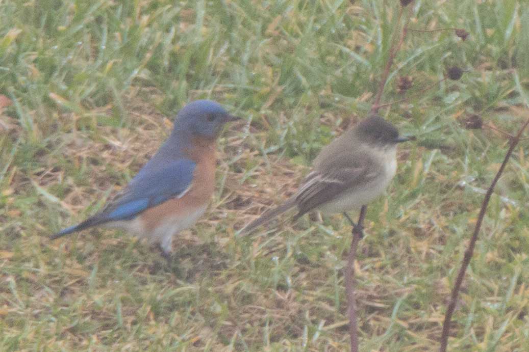
Eastern Phoebe (front) with Eastern Bluebird (back)
Blackwater NWR
Dec. 2014
Resource: American Kestrel Partnership, Declines of American Kestrel populations
In the fields and hedges along Key Wallace Dr. we spotted Eastern Bluebirds, Blue Jays, Flickers, Dark-eyed Juncos, Northern Cardinals, Song Sparrows and White-throated Sparrows. One Eastern Towhee made an appearance. While stopping at the visitor center we spotted an Eastern Phoebe hanging out around the small pond.
Near the intersection of Key Wallace and Egypt Rd. we happened upon another Kestrel! This one had small blue square tag on its right wing with a black ‘X’ marked on it.
Two pied-billed grebes were swimming in the pool to the left of the small bridge just past the entrance to the wildlife drive on Key Wallace Dr.
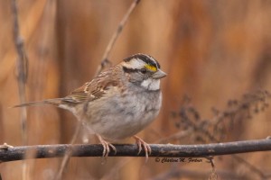
White-throated Sparrow
Blackwater NWR
Dec. 2014
Click on photo for more photos.
The trees and brush along the entrance of the wildlife drive were alive with small bird activity, mostly White-throated sparrows. I found out quickly that in order to reduce the effects of the fog, I would need to focus my photography on closer subjects.
At at the Observation Site/boardwalk we saw 5 American Black Ducks, 2 female Hooded Mergansers and a Great Blue Heron.

Great Blue Heron
Blackwater NWR
Dec. 2014
Click on photo for more
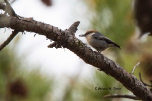
In the wooded pine areas from wildlife drive stops 3-6 there was a lot of activity. We spotted all three types of nuthatches (myself saw the red-breasted and brown-headed, Teddy reported seeing the white-breasted). Other species along this area:
Bald Eagle in extremely foggy conditions at Blackwater NWR
Dec. 2014
We saw two Delmarva fox squirrels at the trailhead for the Woods Trail. Once we spotted them, we attempted to slowly reverse to get a better view but they spotted us and scurried away. (Better photos will be on the report on Dec. 28).
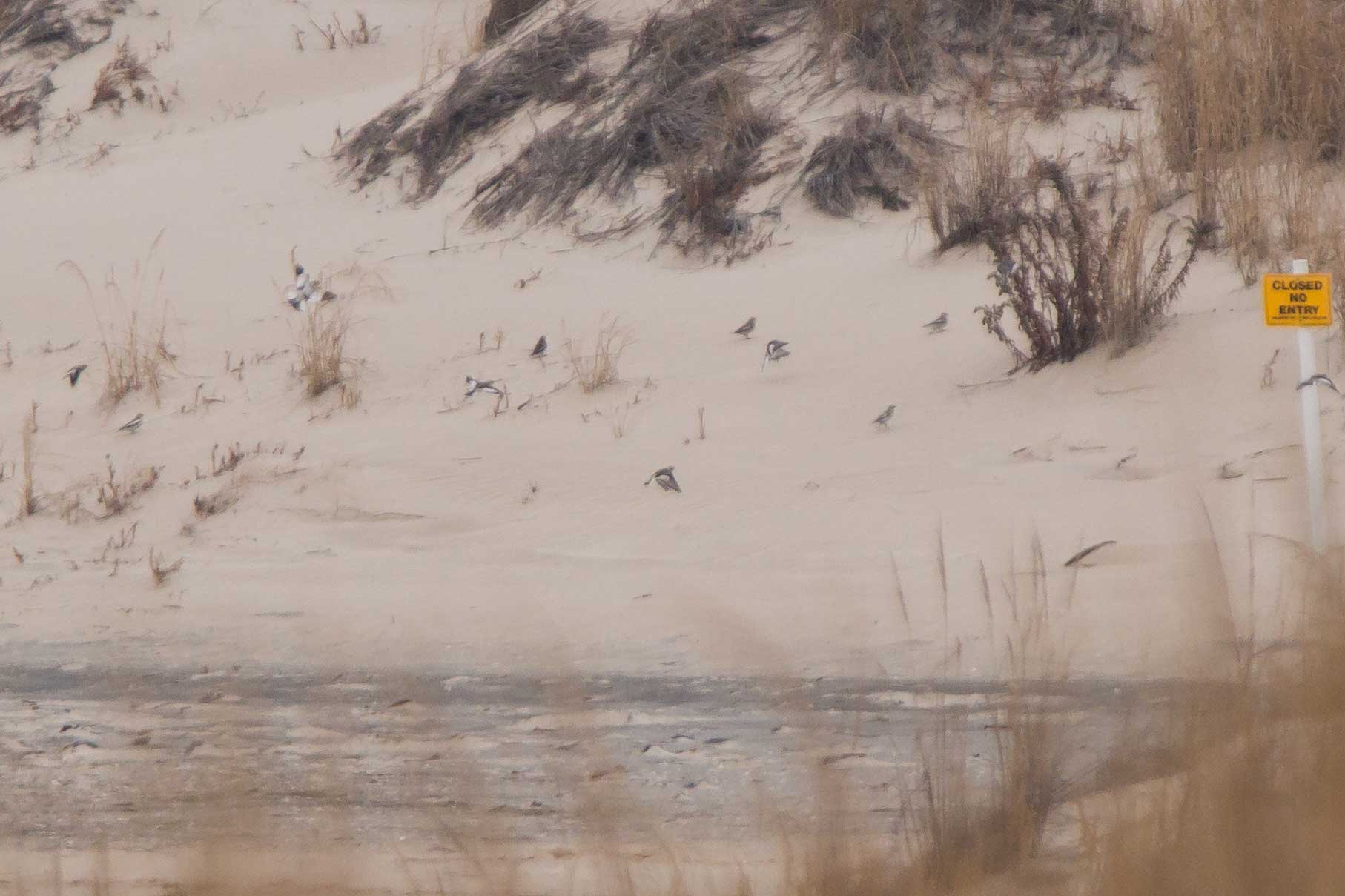
Along the marsh region of the wildlife drive the limited visibility reduced our chances of finding the pelicans that had been reported there. Two vultures perched on the osprey/eagle platform around stop 10 were eventually chased off by two eagles.
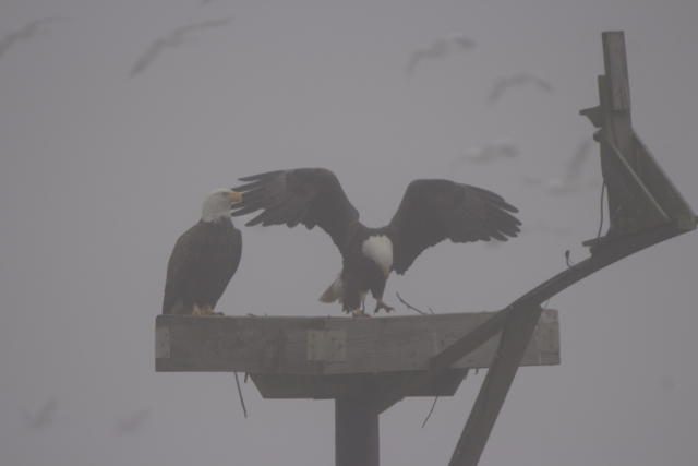
Bald Eagles
Blackwater NWR
Dec. 2014
After leaving Blackwater NWR we decided to drive around in the surrounding areas despite the poor conditions. At Decoursey Bridge we found trees full of vultures with two Bald Eagles visible to the south. On Elliot Island Rd. we spooked two Belted Kingfishers and an Eastern Meadowlark.
December 22, 2014
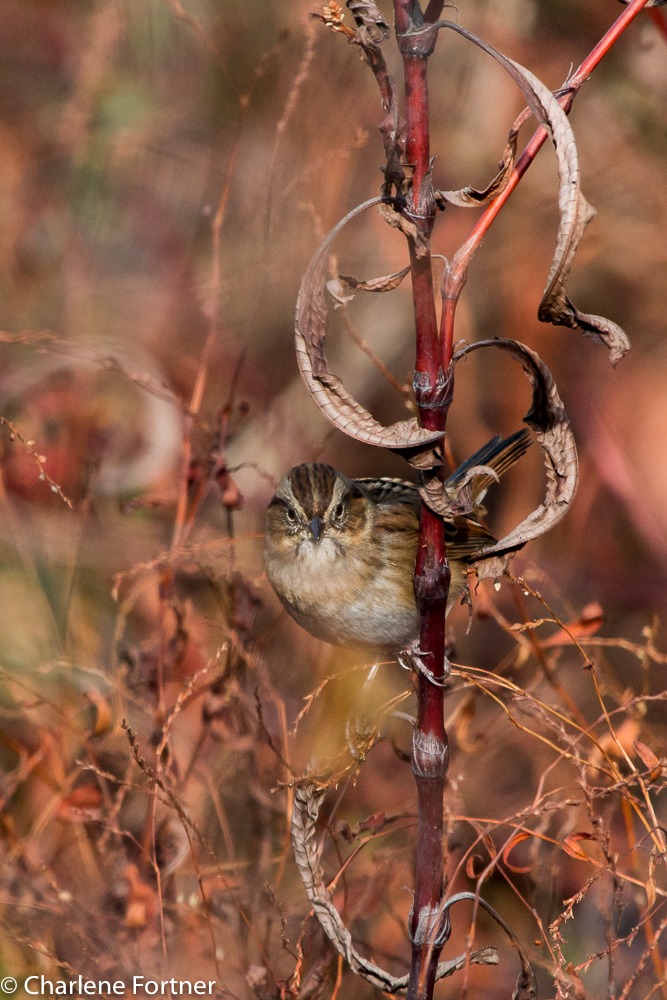
Swamp Sparrow
Cape Henlopen SP
Dec. 2014
Click on photo to enlarge.
Today’s major site was Cape Henlopen State Park. We met a friend of Teddy’s, Rachael, and starting walking along the trail to Gordons Pond from the north. Along the trail we spotted many White-throated Sparrows, Song Sparrows and Yellow-rumped Warblers. A single Harrier and Bald Eagle were the only raptors.
On the water we spotted Buffleheads and two American Wigeons mixed with a small flock of American Black Ducks. At least one American Black Duck showed evidence of hybridization: partially green iridescence of the head. This seems to be a growing concern, but very few resources (and even fewer current resources) indicate the severity of its impact on the species as a whole. Some resources I have found are:
Description and Identification of American Black Duck, Mallard, and Hybrid Wing Plumage from NPWRC in association with USGS
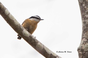
Red-breasted Nuthatch
Cape Henlopen SP
Dec. 2014
Click on photo for more.
A Century of Hybridization Conservation Genetics, 2004. If you are not inclined to read a science paper, this summary/review is good.
Unable to identify them in the field, I later used photos to ID two Swamp Sparrows seen near the north end of Gordons Pond.
Nearing the parking lot, still along the raised portion of the trail in the pine trees, we spotted both Brown-headed and Red-breasted Nuthatches with a small group of Chickadees.
Brown-headed Nuthatch
Cape Henlopen SP
Dec. 2014
Click on photo for more.
After returning to the parking lot, we walked up to Herring Point to spot several Black Scoters and on to THE Point and were pleasantly surprised to easily find a flock of Snow Buntings from the parking lot overlook.
Snow Bunting
Cape Henlopen SP
Dec. 2014
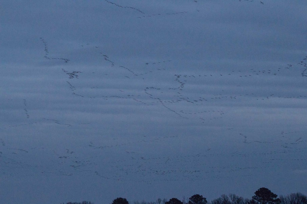
We ended the day with Snow Geese, LOTS of Snow Geese. A large flock across from Epworth UMC in Rehoboth Beach, DE and then on to Prime Hook NWR on the way back home. Thousands of Snow Geese passed overhead at Prime Hook, flock after flock streaming (noisily) overhead for close to five minutes at dusk. I conservatively estimated 5000 in my eBird list.
Snow Geese
Prime Hook NWR
Dec. 2014
I have lightened this photo a little. This is but one snapshot of the amount of geese that passed overhead.
December 21, 2014
This holiday season my good friend and fellow birder Teddy Burke hosted me for a week of Delmarva birding.
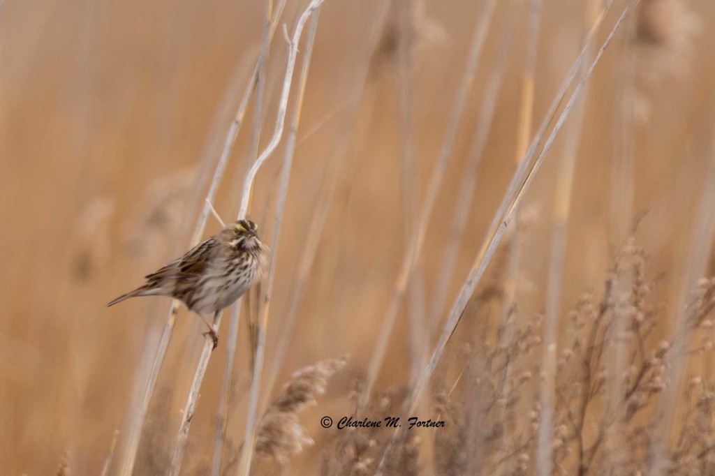
Savannah Sparrow
Port Mahon Rd., DE
Dec. 2014
Click on photo for more.
We started the day at Port Mahon Rd. looking for the elusive Snowy Owls that were previously reported there. Unfortunately, we had no luck. We did happen upon a bald eagle, a few harriers (including one male) and a sizable flock of Ruddy Ducks on the water. On the way out we spooked some smaller birds: four Savannah Sparrows.
Driving up Rte. 9 on the way to our scheduled Christmas Bird Count, we popped into Bombay Hook NWR. While driving along Raymond Pool, a fellow birder alerted us to an American Pipit along the shoreline. I was unable to find it, but by chance looked up and saw the outline of a crane in the grasses across the marsh with the swans. While I’ve seen many Sandhill Cranes in Fairbanks, AK, I was surprised to hear (and see) one was hanging out on the east coast.
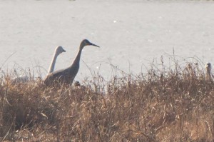
Sandhill Crane
Bombay Hook NWR
Dec. 2014
Our Christmas Bird Count at Sharp Farm, Middletown, DE, did not yield a wealth of species, but I learned a few tips that would help me with identification later in my trip. For instance, I had not thought to narrow my choices for sparrows by paying attention to the streaking of the breast; but then again I rarely pay attention to the smaller birds. 🙂 Our day ended with a Yellow-bellied Sapsucker.
Yellow-bellied Sapsucker
Dec. 2014
Lately I’ve added new pictures to the following species. I hope to make more additions in the next few weeks.
Enjoy!